
Honeymoon recap 03 – Hilo hotel, volcano park and a lava tube
Andrea and I awoke to a slightly cloudy, hazy day on Day 3. High on my personal bucket list, and even higher on our trip “to-do” list, was to see the volcano. We had seen an old lava field the day before, but we knew that there was an official volcano park, with exhibits and active steam vents and lava fields, oh my! So, off we went for the day. The main road that goes along the southern coast of the island passes right through the park — it’s the only road — so it is extremely easy to find. Once you get close, you can see that, yes, this is still an active volcano — smoke and steam are constantly rising through microsteam vents. The ground smokes constantly around the upper caldera.

As a tourist, lots of the crevices look like the volcano is extremely active, but of course, it’s not. It’s just that the heat has to go somewhere (no lava at these spots), and it burns as it escapes, so there is steam and smoke.

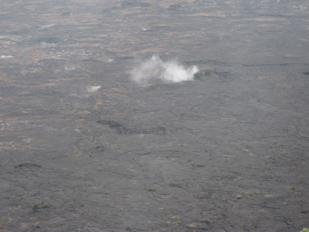
The volcano consists of three layers really: up top (where the picture below is taken from), a “mid-level base” of the volcano that you can see at the base of the cliff (i.e., the floor of the caldera), and then a large “active” pit where the smoke is billowing up.

The mid-level floor is traversable by foot, and you can hike quite close, apparently to the edge of the lower pit. However, it is rated a difficult hike in terms of the uneven terrain of sharp lava rock, plus there are pockets of sulphur gas. Not enough to kill you, probably, but also not recommended for those in less than average health or with respiratory problems. We passed on the hike, and just observed from the upper caldera.

Steam vents and pockets dot the floor of the volcano.
But it’s hard to wrap your brain around the sheer size of the pit until you see little people way down there hiking along. The depth and scale were awe-inspiring.

Hey, look, Panda in a volcano!

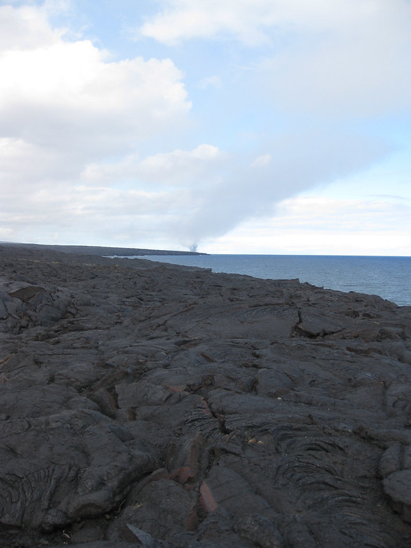
Once you leave the main caldera area, you can drive down a long long long road to the sea to see where an old lava flow passed through leaving behind a dead lava field. You’ll see on a map below that there are essentially three areas of lava, if you were looking at the island from the sea.

On the right is the lava field we saw yesterday, which was about 10+ years old. Then on the left, you would have the pictures below, about five years old, but it covered up a previous one. In the middle (the steam plume you’ll see, and which you saw yesterday), is where the active lava continues to flow into the sea.
Below is an archway carved out by the sea.
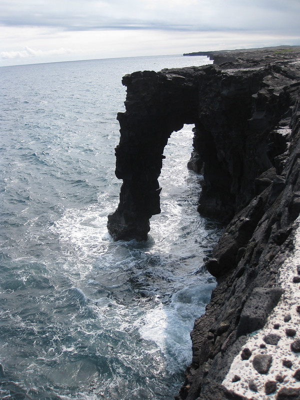
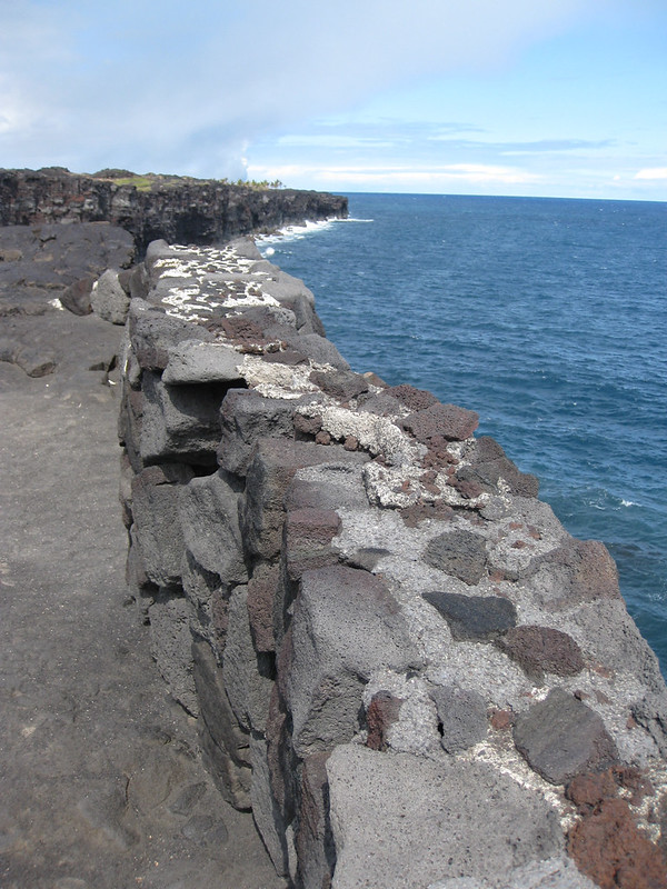
This was the shoreline looking east and north along the coast, which had 5-year-old lava, then active lava, then 10-year-old lava.
We took pictures of Andrea and I in front of the old lava. This flow was a lot more “raw” than we had seen the day before. Larger, rougher, more elemental.


The reverse angle from yesterday of the steam plume from active lava hitting the sea.

A cold lava field — time to go hiking! Very careful, slow hiking.

Yes, we kind of got that message.
The lava rock creates incredibly complex and cool patterns as it cools.

And again, as with yesterday, strange colouring as the rocks cooled at different rates.

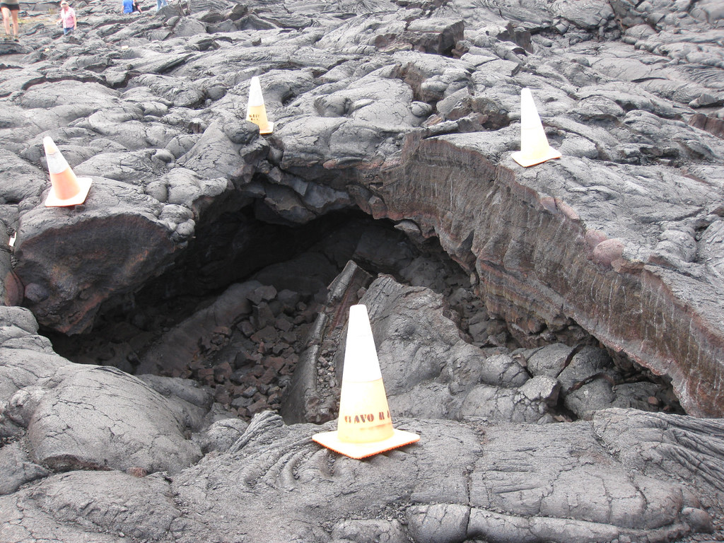
The field has “lava benches”, which are basically pockets of open space in the lava that can collapse. This was old lava, and a small pocket, so the danger was basically ripping your skin to shreds on the lava rock, but out at the shore, those benches could collapse and drop you 50 feet into the sea along with a couple of tons of rock. More dangerously, there are people who have hiked across the old lava until they get to the new lava, and keep on going until they are actually close to the active magma. I have friends who have photos of themselves 20 feet from an open vent hole, at the same park. They obviously have a different sense of risk than I do because. every year, there are people who end up having to be rescued out on the flows when they (a) become overcome by sulfuric gas; (b) trip and fall and hurt themselves badly on the sharp lava and can’t get back; (c) find their escape route blocked because lava shifted and holes opened up; or (d) lose their shoes because they melted and then they had nothing on their feet to traverse the lava rock for the trip back. Very few have actually died, but the locals think they’re all nuts.
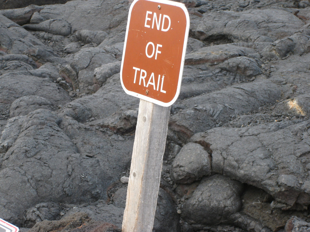
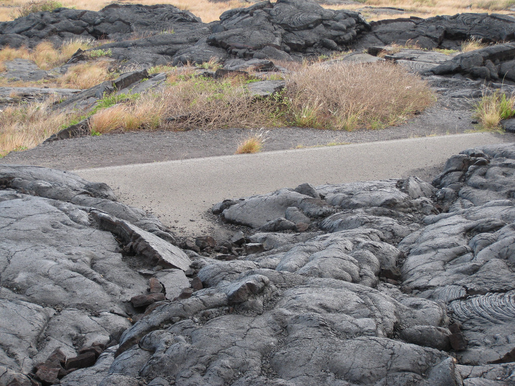
This is where a road used to drive up to an old field, before a new lava flow covered it and the signage.

You can see the remains of the old road here.
This shot shows where the lava came down the hill, and how some of the vegetation is fighting its way back.

I thought this was the coolest tree I had ever seen. The photos really don’t do it justice. Stark white against a black background, but the hazy day and drifting steam and smoke gave me big challenges for light balance on a basic point-and-shoot camera.


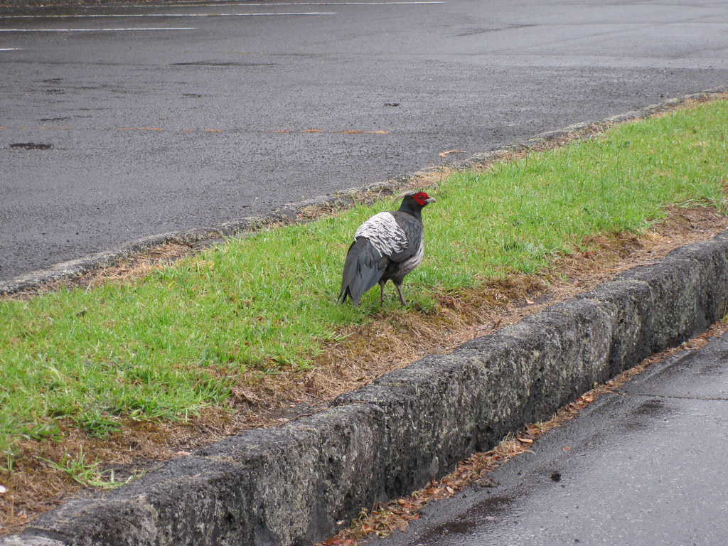
These roosters are all over the island, and they run / live free. Some people suggested there were “chicken protection laws,” but the reality is that they are just really prevalent, often having escaped breeders and farms. It’s also an island (they can’t leave easily) and there aren’t that many local predators! So, we saw them everywhere, and I had to get a shot.
The picture below is kind of hard to see, again partly due to the haze but also in this case partly due to the distance, but this is the floor of the caldera, and running across the middle, slanting up to the left, is a heat line showing a different temperature at some point.

One of the cool things about magma is that it is a bit like water in that it takes the path of least resistance (fyi, magma and lava are essentially the same thing, with magma being below the surface and lava being on the surface). However, unlike water, resistance thresholds have to be pretty high to resist magma, and when magma flows, it creates giant lava tubes (technically magma tubes) like the one below. Often these are just left filled in when the lava cools or the tunnel/tube collapses, but in this case, it just left a hollow tube which is now a tourist attraction.
Andrea and I went to another one while we were in Hilo…kind of a strange setup. The guy basically had moved there with his dad from Oregon and bought the tube entrance as a business. Yep, not the tube; he just bought the entrance. You pay him some money, and he takes you down a few rough steps to a trail that descends into a lava tube and runs about 200 feet underground. At that point, the cave starts to shrink down, and while the tube goes on for several miles, snaking and interconnecting (there were other entrances, and they were mapping it for spelunker types), you wouldn’t want to do it if you were even remotely claustrophobic. Apparently, some of the “gaps” were basically not much thicker than your body before the tube would open up again into a larger cavern. Gives me the willies just thinking about it. The one below was nice and spacious, and not very long. The floors were really quite smooth. I couldn’t get a great shot because of the lighting, so I’m including a postcard version.

Two pandas at the end of the tube (or at least the end of the public portion).

To wrap things up, I have included two videos after the sign-off block. The first is the lava field by the shore and the second is a grainy video of the inside of the lava tube. Enjoy!
