
Trip to New England, 2023 – Day 05 – Baxter State Park (Goal 60×60.42.5)
We awoke in Bangor and our plan for the day was to visit Baxter State Park (photos 1-2). Jacob had taken the lead in planning our visit to Maine, and he really wanted to see the mountains in the park including Katahdin.
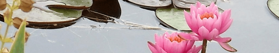
We had a really good breakfast at the hotel, with a nice setup overall and not too crazy busy. We drove to the park, near Millinocket, about 90 minutes north of Bangor itself (photos 3-9). We entered at Togue Pond Gate, after stopping at the info centre to plan the day. Between getting out of the hotel and up the highway, and then through the gate (photo 10), it was almost lunch time. We stopped at Abol Pond for a picnic and to enjoy the scenery after the car ride. It is part of the Appalachian Trail, with a cute bridge, some frogs and some salamander-like fauna in the water. Very peaceful (photos 11-32).
We drove on and stopped at Stump Pond (photos 33-43). It was our first view of Katahdin Mountain, the highest peak in Maine at 5269 feet. There’s no road to the top, so if you want to get there, you have to climb. Not on our schedule for the day, fortunately. There were some logs in the pond, surrounded by swamp, and on a hot day, I assumed there would be turtles all along the logs. I never saw any all day. I don’t know if they don’t have them, or if I was just not finding them.
We continued to drive through the park, catching glimpses of the mountains as we went (photos 44-59). We stopped at an area called the Slide Dam, which seemed oddly named as I saw neither a slide nor a dam anywhere in the area. There were some people wading in the slow rapids, and there was a nice mountain view, along with a small set of falls/creek merging with the river (photos 60-75). Some more driving produced more peek-a-boo shots of the mountain (photos 76-77) and then it was time for…Ledge Falls. It’s a large natural splash pad, with lots of people swimming and drifting down the rapids. A local adventure camp had about 10-12 young men out for the day and were swimming plus teaching them about nature. The spot had a great layout, a mix of fast and slow rapids, nothing too scary for kids, and a nice set of small falls at the top. The swimming was topped off by a nice view of the mountain view above (photos 78-97).
This was the farthest part of our trip through the park, so we turned around and headed back down the Eastern edge of the park that we came up. We passed Foster Field which had a good view of the mountains ahead and the ones now behind us too (photos 98-108). Kidney Pond was shown on the map, and we thought it might be a good scenic pond to visit. We had no real expectations for the diversion off the main road, we had just flagged it for follow-up on our way back. The surprise was that as we crossed a small bridge over the same river we saw at Slide Dam and Ledge Falls, the river delta opened up and we had our best views of the mountain of the whole trip (photos 109-111). Spectacular. We never made it to the pond, the trail was too long for our schedule, so we tried for Daicey Pond and campground. It had a canoe launch, but not much else to see. Again, on the way back, there was an open area with a great view of other mountains in the chain (photos 112-124).
We left the park and headed back out the highway. As we drove, Jacob mentioned that there was this other pond he really wanted to try to reach. It had been in a lot of the photos he saw of the mountain, as if it was the perfect spot for taking photos. It was called Compass Pond, but it wasn’t part of the Park, it was off the highway to the left somewhere. And so began the adventure. The road to get closer to the pond was brutal. It was a wide dirt road, with huge potholes and rocks. We were in a cross-over SUV and it was a pretty rough ride. I think it would have been jarring in a 4×4, to be honest. It finally merged with this huge wide gravel road, wide enough for four lanes in fact, with some grading issues in places, but easily drivable. We drove along for a bit, and there were no roads going to Compass Pond. We could see the pond, but no specific place to park, nada. How did people take the photos? I wasn’t sure, but well, I could improvise. I turned around and drove slowly along the road until I found a small trail going towards the pond. It wasn’t far, maybe 125 feet or so through the woods. We parked, hiked, snapped some pics, fed all the local bugs, and then raced back to the car. But we got the photos (photos 125-129).
As we continued back, we passed through some cottage country lakes (photo 130) and then we decided we would take a detour north to a supposedly great scenic lookout of Katahdin off the highway. Bear in mind that the mountain is about 45 minutes driving time from the highway, and you can barely see it from the highway (photos 130-134). It was a nice view of the estuary and river, with faint mountains in the distance, but it was time to go back. We debated a bunch of options for where we were going to eat along the way, but we just pressed on and finally went to Wendy’s near our hotel.
It was a great day for weather, with perfect viewing and not deadly hot for us. Jacob planned a great outing for us, among the best of the trip. It was a long day for driving distance, 384 km, although up until the final drive on the highway, it didn’t seem that bad for most of it. We had lots of great sights to see, with 332 photos taken and curated down to 135.


