
Trip to New England, 2023 – Day 03 – Vermont to New Hampshire (Goal 60×60.42.3)
Day 3 was moving day! We were finishing Vermont and heading onward to New Hampshire (photos 1-2).
We had breakfast at the hotel, again, and then packed up, playing the second game of Car Tetris to pack the car back the way I did when we first left Ottawa. We took some photos around the hotel before we left (photos 03-08).
We drove up past the Gondola SkyRide again and onward to Smuggler’s Notch. The road had some nice canopy as we got closer and then it got jiggy pretty quick (photos 9-16, with 3 short videos). There were lots of signs about not doing the route in the winter in big trucks, but honestly, the actual “notch” is about one and a half car widths wide, and a tight turn. I had lots of room in our cross-over SUV, and I still felt like it was tight, there’s no way I would want to do it in anything big. It’s basically two giant rocks, with a small diagonal path between them. Beautiful area though, with some small waterfalls beside the road.
Next, we headed to the Moss Glen Waterfalls. If you feel a sense of déjà vu, it’s because we went to a waterfall with the same name the day before. This one is located just outside Stowe and was on the way to New Hampshire anyway. It was interesting to drive out the North-East side of Stowe as we also found another grocery store, and a few more businesses. We had wondered where the locals shopped, as there wasn’t anything really grocery-like in the main part of Stowe.
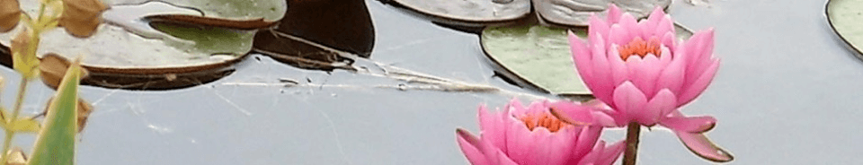
The waterfall area is a strange combination of formal infrastructure with an untouched ravine. There is a small path made of dirt, wire-mesh and/or boardwalk through vegetation and a bit of forest. There was one open area of tall bushes about head height that reminded me of the scene in Jurassic Park: The Lost World where they’re all walking through a large field and the raptors are making beelines for them through the tall grass undetected. We got to see a bit of river, and some rapids, before getting to the big waterfall. At this point, there is almost NO infrastructure at all, other than a small area of fencing to stop you from an area that looked like it might be prone to erosion and collapse. You scramble up an embankment of about 30-40 feet in height comprised mostly of slippery rocks and tree roots and a series of “ledges” that resemble stairs of sorts. Or at least, that’s what you use them for, even if they’re more sloped, slippery, and a really good way to twist an ankle or to fall and break a femur. But hey, what can go wrong on a trip to Vermont? (Small aside — we have a friend who took a trip to Vermont and literally fell and broke her femur while on an easy hiking trail).
It was a great waterfall (photos 17-54), well worth the visit, but getting back down was even harder than getting up. And since it was only supposed to be a very short walk from the parking lot, which was true, we didn’t anticipate it being super hot climbing up and down the hill. By the time we got back to the car, we all needed hydration pretty soon.
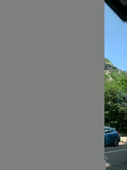
We drove through northern Vermont, with lush mountains and some rivers, lots of beautiful old houses, many done up as BNBs. We saw two covered bridges, and visited Hardwick, a cute town with a big grass square. We had lunch in St. Johnsbury. Lots of places were not open for lunch, so we opted for a café called Yummies at the Star, a cross between a snack bar and a diner attached to a movie theatre. It wasn’t exactly a gourmet menu but at least they had really good milkshakes, and a young girl running the place by herself and doing a fairly credible job of it. We crossed over into New Hampshire by bridge and could see the White Mountains for quite some time before we got to them. They were less green and bigger than the mountains in Vermont, more rugged, more pointy…more imposing and close together (photos 55-74). We arrived in Gorham, with lots of restaurants on the main street.
Since our hotel room wasn’t ready yet, we drove to the base of Mount Washington and the “autoroute” if you were to drive up it. I seriously thought about it, I admit. I wanted to do it. But I wasn’t sure what it would be like, would I “enjoy” it or feel like I “survived” it? We had other plans for the mountain for the next day, so we settled for viewing the Presidential Mountains. We had good clear views, and in fact, had had beautiful weather most of the day. We saw the Google Car and the parking lot had a pretty good selection of license plates (NY, VT, NH, ME, MA, PA, OH, FL, NC, UT, CO, QC, NS). We visited the gift shop and then headed farther south towards Jackson, to the end of the White Mountain National Forest (photos 75-97).
Then we retreated back to Gorham to our hotel (the Quality Inn) with dinner at J’s Corner restaurant near the hotel. And Andrea had her first lobster roll of the trip.
Overall, the driving wasn’t too bad for the day, 246 km, although there weren’t as many stops in the middle section. For photos, we took 271 which has been curated down to 97 for the gallery.